
Find People Along a Glastonbury Street
A Glastonbury street directory search is a chain, not one button. The safest first step is to normalize the address, then let each custodian answer its own question. GIS supplies the parcel and geometry. The Assessor supplies a tax record with an owner field, mailing address, and value. USPS checks postal form. The Town Clerk ties a party name to a recorded instrument. Dated directories and newspapers can add household context.
The order below keeps the street angle separate from a one-person lookup. It also avoids treating a mailing address, mapped situs, and person’s residence as interchangeable.
- Enter the street and town in the Glastonbury GIS viewer, then save the AddressLabel, ParcelID, map, block, and lot.
- Use the parcel key in the Assessor or Vision database and record the Grand List or revaluation date beside the displayed fields.
- Run the same address through USPS to confirm the postal city, state, and ZIP returned for that location.
- Search the Town Clerk index by party, date, instrument, book/page, or map reference, because an address alone is not a deed search.
- For an older household, compare a dated directory, newspaper page, cemetery lead, or vital record without turning the historical clue into a current claim.
Find a Glastonbury Street Parcel in GIS
The town’s GIS and mapping property information page links to physical-location maps, assessment field cards, land records, utilities, and address lists. Its public ArcGIS parcel layer exposes AddressNum, StreetName, AddressLabel, ParcelID, PropertyID, ParcelArea, ParcelAcres, Map, Block/PID, Lot, CommonName, geometry, and source or update metadata.
Click a parcel only after checking the street label and town. Save the layer name and query date. The service supports geometry, spatial parameters, result offsets, and a 2,000-record maximum. A parcel is a mapped administrative unit, not a survey or a statement about the people connected to it.
| StreetName and AddressNum | Match a visible street and number to the mapped address label. |
|---|---|
| ParcelID and PropertyID | Carry the local parcel keys into an assessment or land-record search. |
| Map, Block/PID, and Lot | Connect a current parcel to older maps, deeds, or lot references. |
| SourceDate and UpdateDate | Record the layer’s stated time context beside any address finding. |
- Parcel
- A local mapped land unit identified by parcel and map fields.
- Situs address
- The physical location assigned to a parcel, distinct from a tax mailing address.
- Plat or map reference
- A drawing or identifier that can connect a legal description to a parcel.
- Criss-cross directory
- An address-order directory format; a dedicated Glastonbury reverse run was not verified.
The parcel layer is most useful as the bridge between a visible address and the record keys used by the Assessor and Town Clerk.
Confirm Glastonbury Postal Address
The USPS ZIP Code Lookup has three modes. By address uses Street Address and City, with State required and Company, Apt/Suite, and ZIP optional. By city and state returns the ZIP results for that postal city. Cities by ZIP returns recommended city names. These are postal tools, not municipal resident lists.
Run USPS after the GIS match, not before. South Glastonbury appears as a postal-city label in the 06073 post-office result, while Glastonbury appears with 06033. Delivery boundaries are address-specific, so a city/state list should not be used to assign a ZIP to every parcel in town. USPS also warns that a returned address does not confirm that a person or company is there.
When an old directory uses East Glastonbury or South Glastonbury, preserve the printed locality and the modern postal result as two dated fields. That distinction helps a street directory remain useful without rewriting local history.
Glastonbury Records Searchable by Street
Address-keyed records in Glastonbury overlap, but they do not mean the same thing. The table separates a parcel map from a tax record, a deed index, a permit event, and a voter route. Use the layer that answers the narrow question, then corroborate with a second source.
| Record set | Keeper | What it can show | Access route |
|---|---|---|---|
| Assessment and field card | Glastonbury Assessor | Owner field, mailing address, parcel data, values, characteristics | Vision entry, field-card link, counter or phone |
| GIS parcel layer | Engineering and GIS | Geometry, address label, acreage, map/block/lot, zoning context | Viewer, REST query, map library, data request |
| Deeds and related instruments | Town Clerk | Parties, recording date, book/page, legal description, linked records | Free index; paid image, workstation, mail, or in-person copy |
| Voter registration | Registrar and Secretary of the State | Registration status under public fields and privacy rules | State lookup, Registrar, or written registry request |
| Building permits | Building Inspection and Zoning | Address-based application, review, inspection, and upload trail | OpenGov route or town office; live fields need checking |
The parcel identifier is the useful tie. It can connect GIS to the assessment record, then point toward a party name or map reference for the land index. A street name by itself is weaker because older instruments can use a lot, subdivision, or metes-and-bounds description.
Read a Glastonbury Street Assessor Field Card
The Glastonbury Property Assessment office maintains public assessment information and links to field cards, maps, GIS, sales, exemptions, appeals, and revaluation material. The assessment process says a property card may include owner or owners, mailing address, parcel size and location, assessor map number, parcel or lot, and a unique parcel number.
The annual Grand List is prepared as of October 1 and is printed in owner or business alphabetical order across real estate, motor vehicle, and personal-property lists. Values are tax-administration fields. Put the Grand List or revaluation year beside a value, and never call an assessment a sale price.
Mailing address and situs are separate fields. If they match, the record displays the same address in the inspected fields, not proof that the owner lives there. If they differ, the mailing address is not evidence of vacancy or of no local connection.
Search a Glastonbury Street Directory Through the Town Clerk Index
The SearchNG land portal covers May 4, 1693 to the present. It is free to search, but images and printing use a paid subscription or a lower-level Town Hall workstation. Search a party with spelling variants and a shortened first name before adding too many filters.
These controls are documented in the live portal and give a street directory its most useful record trail:
| Party Name | Last-Name First-Name, with company names allowed and no commas. |
|---|---|
| Date Range | From and To in MM/DD/YYYY, plus 7-day, 30-day, and 90-day shortcuts. |
| Instrument | Document type, instrument number, book/page, and printing controls. |
| Parcel clue | Town, Lot/Block, or Legal Description Line 1 when a map reference exists. |
| Result | Party role, document type, recording date and time, pages, consideration, legal description, links, and image state. |
Record whether a result is a direct or indirect party, whether the image is available, and whether an asterisk or R/C annotation appears. The free index is not a certified copy or title conclusion.
SearchNG’s recorded controls are shown at the official source.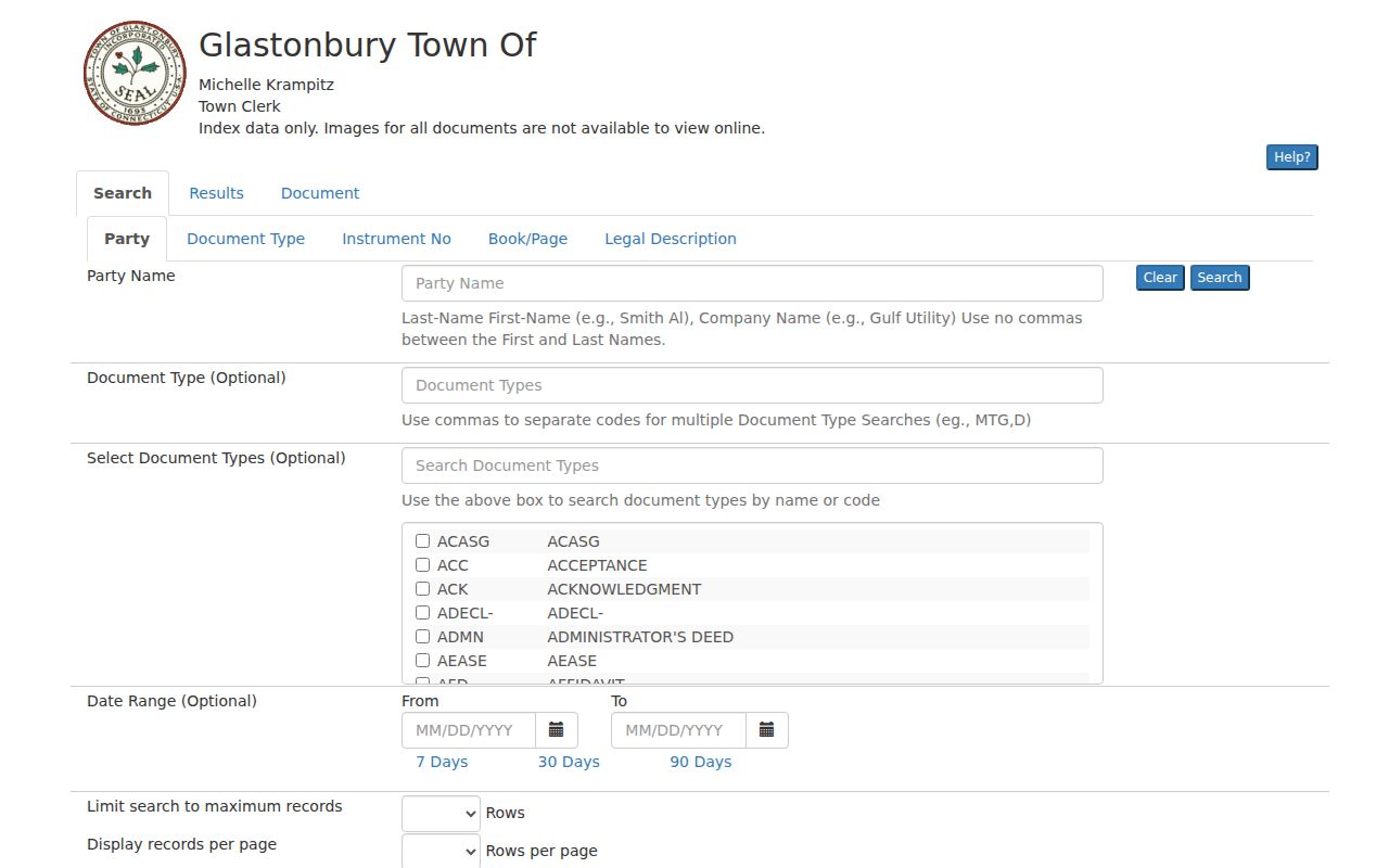
The image is a portal reference, not a sample personal result. Search a real record only for a defined, lawful research purpose.
Glastonbury Street Deeds, Maps, and Copies
The Town Clerk maintains deeds, mortgages, releases, easements, liens, maps, trade names, and related instruments. The online index is the fast route to a party or recording date. The image and certified-copy routes are different: online images and printing have fees, while a written certified-copy request is listed at $1 per page plus a $2 certification charge per document.
At the lower-level Town Hall workstation, researchers can inspect the index and request help during weekday service from 8:00 a.m. to 4:30 p.m. Land records can also be recorded or copied by mail, in person, or through eRecording procedures. For a boundary question, read the legal description and referenced map, not just the street label.
The Town Clerk land-record page is the current place to verify office contact, fees, and copy instructions. A GIS export is not a certified deed, and a tax account is not a title instrument.
Glastonbury Permits Add Address History
The town’s building permit route points to OpenGov ViewPoint for permit and history work. The town page describes an account and property address workflow, along with plot plans, A-2 surveys for new construction, estimated cost, energy compliance, contractor license material, fees, uploads, payment, and a review period that can run 10 to 30 days.
The live vendor fields were not exposed during the research capture, so do not promise a particular result column. A permit record shows an application, review, inspection, or construction-related event. It does not identify every person who used or occupied the address.
For the street directory chain, use a permit as dated property context after matching the address and parcel. Use the Town Clerk or Assessor when the question is ownership or a recorded party.
Glastonbury Street Property Alert Is Forward-Looking
Glastonbury Property Alert is a free email notification service. An account uses a username, password, email confirmation, and one or more registered party-name variations. It sends notice when a document containing a registered name is recorded.
Alert registration begins future notice. It is not a historical title search, and the portal does not guarantee that every lawful document will be accepted, indexed, or matched to a name variation. After an alert, return to the official land index and obtain the instrument through the Town Clerk route.
The captured notice screen can be inspected at the official Property Alert service.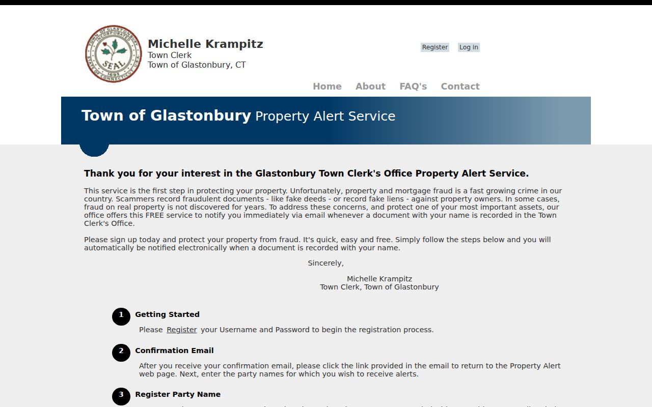
Register name variations carefully and keep the alert date separate from the recording date.
Historic Glastonbury Street Directory Locality Labels
Older street work can fail because the label changed, not because the record vanished. Official history records Glastenbury and Glastonbury spellings, while older sources use Eastbury as a locality term. The Library of Congress 1972 to 1973 Hartford directory separates East Glastonbury, Glastonbury, and South Glastonbury and dates the local telephone exchange to 633.
Use those terms as search variants with a year. Preserve the spelling exactly as printed in a directory, deed, map, or newspaper. The reviewed official sources did not establish a townwide street-renumbering table, so a changed number should be tested against the legal description, map reference, and parcel identifiers rather than assumed.
Locality labels add context to a Glastonbury street directory, but they do not create separate municipalities or prove that a printed household remains at the address.
What a Glastonbury Street Directory Cannot Show
A street directory can show a mapped parcel, an assessment field, a postal result, a recorded party, or a dated listing. It cannot create a complete list of household members. The public voter route has privacy rules. Vital certificates have event-specific eligibility. The GIS service has a Non-Disclosure Protocol layer, and the Address Confidentiality Program can supply a substitute mailing address for eligible participants.
Do not infer residence from an owner field, a matching mailing and situs address, a business filing, a permit, or a historical telephone listing. If the source is absent, the person may be protected, the record may belong to another custodian, or the portal may not expose the needed field.
Lawful use. Glastonbury address records support personal, genealogical, property, and civic research. Do not use a street search to stalk, harass, intimidate, or harm anyone.
For a block around one parcel, use the Glastonbury neighbor lookup angle. For a historical collection or a dated household, use the city directory shelves rather than repeating a current parcel search.