
How Glastonbury Neighbor Records Work
A block lookup combines map geometry with record limits. The ArcGIS parcel layer answers which mapped parcels touch or surround an address. Assessment fields can add a current owner or mailing field. The Town Clerk can show a recorded party. Voter information is privacy-controlled, and historic directories or newspapers can supply dated context. None is a complete list of Glastonbury neighbors.
| Source | What it shows about a block | Access |
|---|---|---|
| ArcGIS parcel geometry | Adjacent polygons, identifiers, address labels, acreage, geometry | Public viewer and REST query |
| ParcelLabels layers | House numbers, property lines, map references, assessor lots | Public map service |
| Assessor and Vision | Owner field, mailing address, parcel and value context | Online entry and town office |
| Town Clerk index | Recorded parties, deeds, maps, linked instruments | Free index; copy and image routes |
| Voter privacy route | Registration information under public fields and protections | State lookup, Registrar, written request |
| Library and local history | Dated households, organizations, notices, and neighborhood context | Welles-Turner, archive, Historical Society |
Owner, mailing, situs, and occupant are different ideas. A public neighbor result should state which one the source actually supplies.
The useful unit for a block lookup is the parcel or mapped feature, not an assumed household. A result can identify a shared boundary, a road-separated polygon, a parcel label, or a current administrative field. It should retain the layer name and date so another reader can see whether the apparent neighbor relationship came from geometry, an assessment record, or a dated historical source.
Glastonbury’s public map services also expose source and update metadata. Those fields matter when a parcel has been split, a subdivision layer has changed, or a current address does not resemble an older deed description. The map is a research bridge between a location and a custodian, not the final answer about a person.
Glastonbury Neighbor Maps Start with Parcel Geometry
The public Glastonbury ArcGIS parcel layer supports query and geometry operations. Its attributes include ParcelID, PropertyID, ParcelType, CommonName, ParcelArea, ParcelAcres, StreetName, AddressNum, AddressLabel, Map, Block/PID, Lot, GlobalID, UpdateDate, SourceID, SourceType, and SourceDate. A query can return geometry, use offsets, and apply spatial parameters, with a 2,000-record maximum.
Identify the target parcel by address or parcel key. Then display neighboring polygons at the same scale and save the map service, query date, and layer name. A parcel touching the target is a geographic neighbor, even when a road or right-of-way separates the homes.
The public parcel layer is linked to the live service.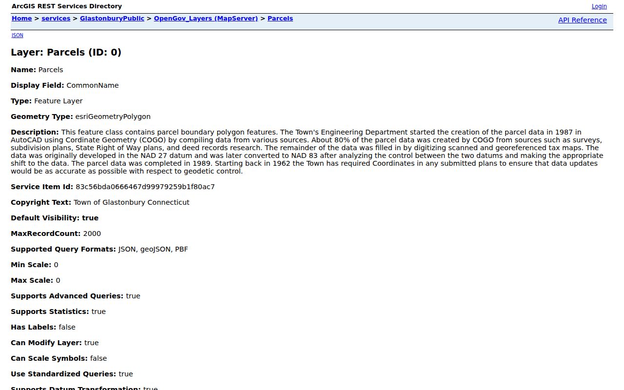
The image is a map-layer reference, not a personal neighbor record.
Map a Glastonbury Neighbor Block from One Address
One address is enough to begin a reproducible block search. The goal is to identify surrounding land units and their record keys, not to collect a private contact list.
- Enter the address in the town GIS viewer and confirm the town, street, and AddressLabel.
- Capture the target ParcelID or PropertyID, map, block/PID, lot, acreage, and geometry.
- Display adjacent polygons at the same scale and note each identifier, address label, CommonName if populated, and source or update field.
- Check whether the apparent boundary is a shared line, road or right-of-way, condominium or co-op relationship, or only visual proximity.
- Cross-check any owner or common-name field in the current Assessor or Town Clerk source before writing it as a record fact.
For the full named-street chain, use the Glastonbury by-street record workflow. Neighbors work should stop at the immediate block or radius.
The parcel map shows geography. It does not show every household member, a relationship between people, or a private utility account.
For map-only questions, a parcel identifier and date may be all that a reader needs.
The ParcelLabels view is shown below as a reference for map labels and parcel identifiers.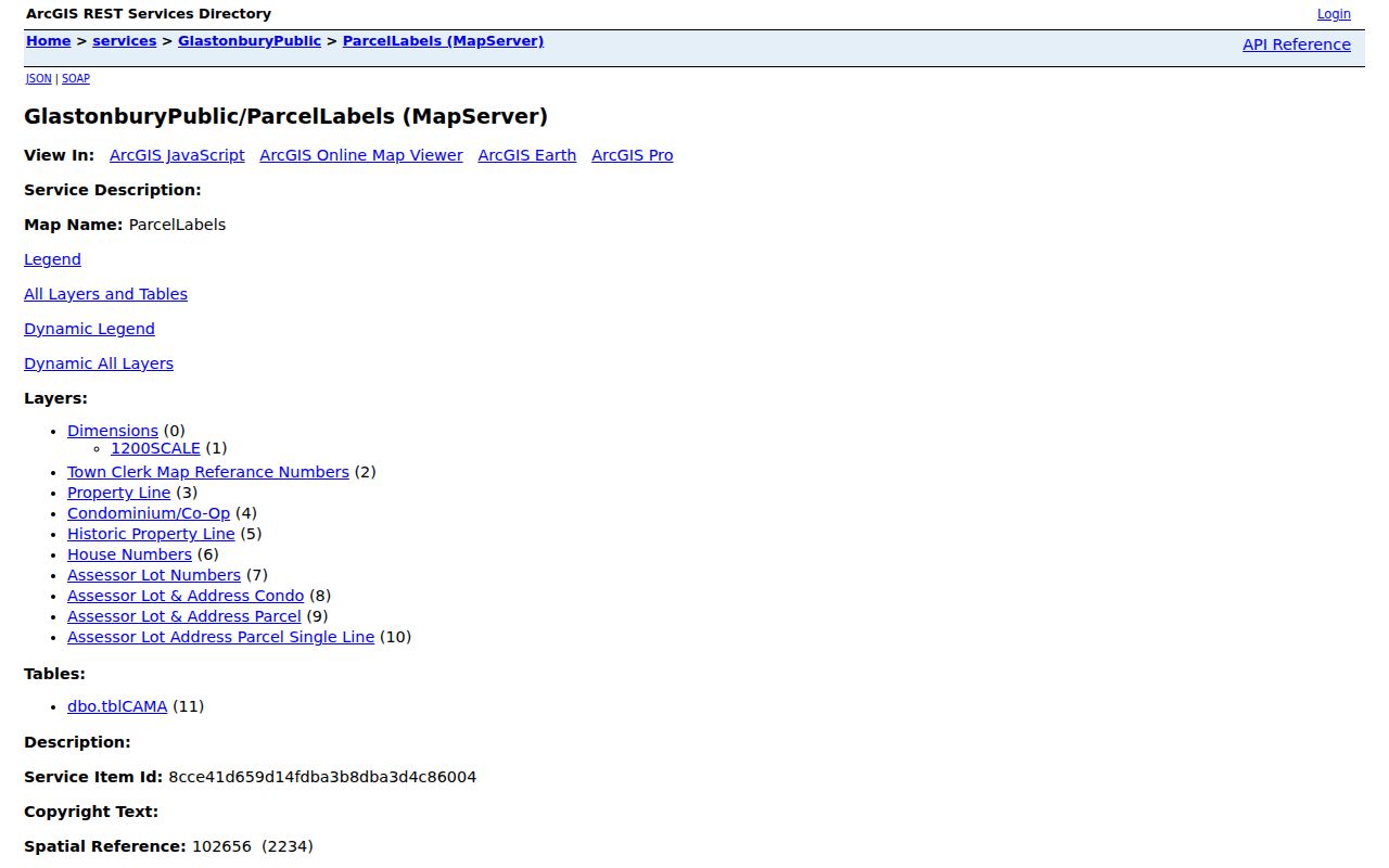
The ParcelLabels source adds map references and labels that can help explain why a parcel boundary looks different from a street view.
If the target sits near a road, river, right-of-way, or condominium boundary, record that feature instead of calling every visible polygon an adjacent home. A map scale can make two parcels appear connected when a separate public feature lies between them. The service’s geometry and the named layer should control the wording.
Read the Glastonbury Neighbor Layer List
The OpenGov layer list includes Parcels, Work Area, Approved Subdivision, Historic District, Town Center Village District, Zoning, and Non-Disclosure Protocol. A layer should be named in the result card because a zoning boundary and a parcel boundary answer different questions.
Historic district and town-center layers can add civic context. Approved subdivision and property-line layers can explain a parcel’s shape. The Non-Disclosure Protocol layer is a reminder that public mapping does not expose every location field. A map view should not be used to infer a protected person’s address from nearby parcels.
The live layer list is linked at the ArcGIS service.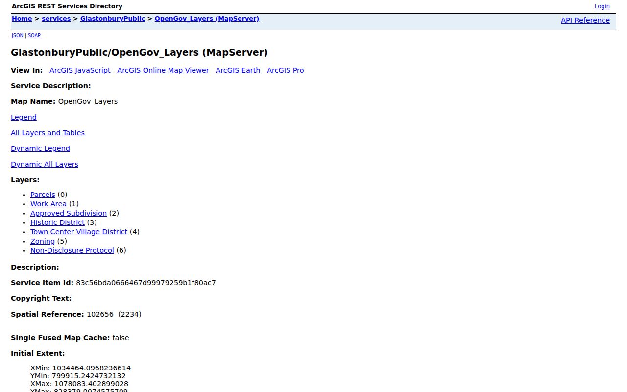
Keep the layer name, service URL, source date, and map scale beside any observation.
Check Glastonbury Neighbor Property-Line Labels
The ParcelLabels service lists dimensions, Town Clerk map references, property lines, condominium or co-op fields, historic property lines, house numbers, assessor lot numbers, and parcel or address labels, with a CAMA table. These labels help translate a map display into the terms used by a land record or field card.
Parcel lines are not a boundary survey. The town’s GIS history includes survey, subdivision, rights-of-way, deed research, and scanned or georeferenced tax-map sources, with later maintenance and coordinate conversion. If a line matters to a dispute, use the recorded instrument and the official professional route rather than measuring a screenshot.
A neighbor result can say that two parcel polygons share a boundary in a named layer on a given date. It should not say that the people connected to the polygons know one another or share a household.
Match Glastonbury Neighbor Assessment and GIS IDs
The Vision assessment entry point and the ArcGIS service are complementary. GIS supplies parcel geometry and source fields. The Assessor supplies owner, mailing address, legal data, values, parcel size and location, map number, lot, and unique parcel fields. Record the Grand List or revaluation year with an assessment value.
When an owner field and mapped location match, write only what the source displays. An owner may use a different mailing address, and a matching mailing and situs address does not prove physical residence. A common-name or owner field should be corroborated with the Town Clerk when a prior owner or transfer is material.
Tax bills and MyTaxBill are administrative routes, not title or occupancy proof. A bill number, account ID, or balance does not replace a deed.
Glastonbury Neighbors Have No Verified Association Roster
Research did not locate an authoritative, townwide public neighborhood-association directory on the official community profile, map library, or online-services pages. Do not fill that gap with an unverified list. Community context is still available through established local institutions.
| Town community profile | Glastonbury’s general community and local-resource context; not a named-neighbor roster. |
|---|---|
| Welles-Turner Memorial Library | Local history, databases, newspapers, and reference help; 860-652-7719. |
| Glastonbury Historical Society | Properties, material culture, genealogy/reference leads, and local research contact; 860-633-6890. |
| Town online services | Navigation to current official departments and destination portals. |
These are research routes, not association memberships or contacts. If a governing organization later supplies a roster, preserve its name, date, and access rule.
The library’s reference number is 860-652-7720, and its local-history help can point to newspapers, periodicals, directories, databases, or a vertical file. The Historical Society’s 1944 Main Street address and 860-633-6890 number provide a separate local-history contact. Neither institution is a substitute for a current roster, and neither should be described as confirming who lives on a block.
Glastonbury Neighbor Voter Privacy Shapes Block Search
The Secretary of the State’s voter privacy program controls how much a block-level question can reveal. The public registry does not expose every identity field, and eligible people may receive confidential treatment of their name and address. The Address Confidentiality Program can provide a substitute mailing address through an approved advocacy assistant for people facing specified safety risks.
A blank or incomplete voter result may reflect protection, not an error. Do not combine nearby parcel results to guess a protected location. The ACP route explains that the substitute address is a contact route, not the participant’s physical residence.
The captured ACP page is linked to the state source.
Privacy programs belong in the block method itself, not as an afterthought.
Privacy Limits on a Glastonbury Neighbor Lookup
Neighbors can be described at the level of geography, parcel identifiers, map layers, or dated public records. Household members, private contact data, protected addresses, and utility or delivery accounts are not supplied by the public parcel map. A court, vital, voter, or police record also carries its own access rule.
| Official rolls | Named custodian, defined record type, source date, and a correction or copy route. |
|---|---|
| Commercial neighbor tools | Convenience results may combine sources, hide update dates, and offer no clear public-custodian path. |
| Safer result | State the parcel or layer fact, omit unnecessary personal detail, and link the official source. |
Lawful use. Neighbor research is for getting to know a block, family history, property context, and personal safety awareness. Do not use it to stalk, harass, intimidate, threaten, or harm anyone.
A neighbor lookup should end when the geographic question is answered. More names do not make the result more accurate.
A Glastonbury Neighbor Block Is Geography, Not a Relationship
A concise neighborhood result card can identify the target parcel, layer, map date, adjacent parcel identifiers, address labels when populated, acreage, and source or update fields. It can say that a polygon touches another polygon in the public map. It can note that an owner or CommonName field requires current Assessor or Town Clerk corroboration.
It should not claim that a person lives at a situs address, that a mailing address is a home, or that two people are related because their parcels touch. The town map library and GIS service are excellent for civic geography, but the record meaning must stay attached to the named custodian.
For a complete named-street trail, return to the by-street workflow. For a historical household, use the dated directories, newspapers, cemetery, and land sources rather than a current block map.