
Sources for Previous Glastonbury Residents
Past-resident research works best when the source’s time span and unit of evidence are explicit. The land index records instruments. GIS and assessment show current administrative context. City directories and newspapers provide dated publication evidence. Vital, probate, cemetery, and library sources can connect names and events across gaps.
| Source | Years it covers | Where held | What it shows |
|---|---|---|---|
| Glastonbury land index | May 4, 1693 to present | Town Clerk/SearchNG | Parties, instruments, maps, book/page, legal descriptions |
| FamilySearch Glastonbury catalog | 1680 to 1905 | Town Hall originals and two filmed reels | Birth, marriage, death names, dates, places, volume or index leads |
| Barbour collection | 1690 to 1854 | FamilySearch catalog, volume 13 | Abstracted early vital events and name variants |
| Hartford-area directories | 1905/06 to 1973, with gaps | Gale finding aid and LOC scans | Printed names, phones, addresses, locality, business or role labels |
| Glastonbury Citizen archive | 1921 to 2001 digital coverage located | Welles-Turner archive | Dated notices, obituaries, businesses, civic and family events |
| Assessor and GIS | Current cycle and service dates | Town portals and ArcGIS | Parcel, address, map, owner field, mailing address, source/update metadata |
Start with the land index for a legal chain, a directory for a printed household lead, the library for a shelf or clipping route, or a vital and probate source for family evidence. The previous residents question is strongest when each lead has a date and record meaning. No dedicated Glastonbury reverse-directory or Sanborn-map run was verified in the reviewed sources.
Start a Previous Residents Search with Glastonbury’s 1693 Land Index
The Glastonbury Official Records Public Search gives a free index reaching back to May 4, 1693. The detailed SearchNG portal accepts party, date, document, instrument, book/page, map or lot, and legal-description clues. Images and printing require a subscription or a lower-level Town Hall workstation. The land-record page also describes mail, in-person, eRecording, copy, and certification routes.
Use the current assessment or GIS record to get a likely party, parcel, map, block, or lot. Then search the Town Clerk index with spelling variants and a date window. The index can show party role, recording date and time, consideration, legal description, linked documents, page count, and image state.
The subscription entry screen is available at the source URL.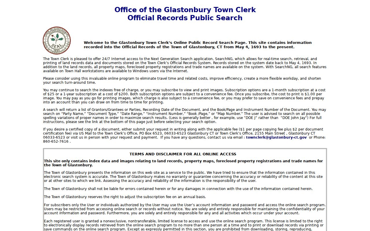
The image shows the public records route. It does not turn an index hit into a title opinion or a residence finding.
Trace Previous Residents Through the Hartford County Deed Chain
Hartford County is a geographic locator, while the Glastonbury Town Clerk is the local recording office. A backward trail starts with the current parcel and moves through recorded instruments, not through a county recorder. Follow the legal description and linked prior document at every step.
- Save the GIS AddressLabel, ParcelID, map, block, lot, geometry, and service date.
- Read the Assessor field card for the owner field, mailing address, value, parcel key, and Grand List or revaluation date.
- Search the Town Clerk index for the likely current party, using date, document type, map or lot, and spelling variants.
- Read the deed image or request a copy, then record grantor, grantee, instrument, recording date, book/page, consideration, and legal description.
- Follow the prior instrument reference backward, stopping when a subdivision, trust, estate, condominium, merger, or boundary change makes the parcel match uncertain.
- Grantor
- The party shown as transferring an interest in the recorded instrument.
- Grantee
- The party shown as receiving that interest.
- Chain of title
- A sequence of recorded transfers and related instruments tied to the same legal description.
- Legal description
- The deed or map language that identifies the land, often more reliable for old records than a street number.
Ownership evidence and residence evidence are separate. A previous resident may appear in a directory or newspaper without appearing as a deed party. For previous residents, a recorded transfer is only one part of the address history.
Read Glastonbury Previous Residents Maps and Parcel References
The town GIS page links parcel maps, field cards, land records, utilities, and address lists. The ArcGIS parcel service supplies map, block or PID, lot, acreage, address, geometry, source, and update fields. The ParcelLabels service adds dimensions, Town Clerk map references, property lines, house numbers, assessor lots, and address labels.
Glastonbury says engineering began GIS work in 1987 and that parcel data came from surveys, subdivisions, state rights-of-way, deed research, and scanned or georeferenced tax maps. NAD27-to-NAD83 conversion and later maintenance matter when a current layer is compared with an old map.
If a street number does not match an old deed, preserve the legal description and map reference. Previous residents can remain traceable even when a number or locality label changed. The reviewed official sources did not establish a townwide renumbering table. A map-data question can go to Engineering through the Electronic Map Request Form, with ESRI shapefile or AutoCAD 2014 DWG as the documented formats.
Welles-Turner Helps Trace Previous Residents
Welles-Turner’s databases and local-history route brings together newspapers, genealogy resources, ResearchIT CT, HeritageQuest, Hartford Courant, and other changing subscriptions. Ancestry Library Edition is described as an in-library resource. The library’s collection policy points deeper family manuscripts and local ephemera toward the Historical Society, Connecticut State Library, and Connecticut Historical Society.
Ask reference staff for a dated newspaper page, vertical file, map, directory reel, cemetery lead, or local-history source. A dedicated Glastonbury house-history guide was not located, so do not promise a special online service. The library is still the practical place to ask which shelf or database can fill a gap.
The local-history database route is shown at the source URL.
Use the library to locate dated evidence, then cite the title, date, page, reel, or collection identifier.
Past Glastonbury Households in Directories
Owners are only one part of the previous-residents question. The Hartford Suburban runs, Hartford directories, and Library of Congress volumes can show a printed name, telephone number, address, business or role label, and locality. The 1972/73 volume uses exchange 633 and identifies East Glastonbury, Glastonbury, and South Glastonbury pages.
Use the Glastonbury city directory collections page for the full shelf and entry-reading method. Here, the task is to pair a dated listing with the deed or map trail. For previous residents, repeat the search in the next available volume, mark gaps, and use a newspaper, probate, vital, cemetery, or Historical Society lead to explain a change.
- Copy the directory year, locality, printed name, address, phone, label, and page image.
- Place the listing beside the nearest deed, map, census, or vital event date.
- Search the newspaper archive for the name plus street, business, cemetery, or town-history term.
- Label the conclusion as listed, recorded, published, or corroborated.
Disappearance from a directory can mean a gap, move, changed surname, unlisted number, or publication change. It does not by itself establish death or a new address. A previous residents trail should preserve that uncertainty.
Glastonbury Previous Residents and the 633 Exchange
The 633 telephone exchange is a useful historical marker. It belongs to the Library of Congress 1972/73 Hartford directory, where Glastonbury, East Glastonbury, and South Glastonbury locality sections appear. A printed entry can therefore help place a name and street in that volume’s time frame.
Do not carry the exchange into a current phone claim. Do not treat a telephone listing as proof of ownership, household composition, age, or current presence. For a previous-resident evidence card, write the volume and page first, then the exact listing and its limitation.
| Source date | 1972/73 Hartford directory, Library of Congress. |
|---|---|
| Printed fields | Name, seven-digit number, street address, occasional business or role, locality. |
| Historical use | Date a published listing and create locality variants for a newspaper search. |
| Not established | Current residence, ownership, spouse, age, or household size. |
FamilySearch Cross-Checks Glastonbury Previous Residents
The FamilySearch Barbour catalog includes Glastonbury in volume 13, covering 1690 to 1854. The separate Glastonbury catalog covers births, marriages, and deaths from 1680 to 1905, with originals at Town Hall and two reels filmed in 1982. The statewide wills and deeds collection adds a different archival search route and may require login or affiliate access.
These collections are valuable for early name variants, dates, parents, spouses where the record supplies them, and event places. They are not a current address list. Confirm a name that leads to a property question through the Town Clerk land record or a current parcel source.
The Barbour catalog is linked to the live FamilySearch source.
Keep the catalog number, volume, film or image context, and original-custodian note with any family-history lead.
Property Alert Limits for Glastonbury Previous Residents
The Town Clerk’s Property Alert sends a future email notice when a document containing a registered party name is recorded. It asks for account credentials, email confirmation, and name variations. It does not search the past, certify title, or guarantee that an accepted document will match every variation.
For a prior-resident project, use Property Alert only as a forward-looking supplement. A notification should send the researcher back to SearchNG, the document image, the deed chain, and any map reference. The recording date and the alert date should remain separate.
A current assessment or GIS result also cannot stand in for an old chain. Revaluation and service dates belong beside current administrative fields.
Historic Glastonbury Names Need Context
Glastonbury history records Naubuc Farms, Eastbury, Glassenbury or Glastenbury, the Connecticut River ferry to Rocky Hill, shipbuilding, J.B. Williams, orchards, Peach King, and other local industries. Those terms can uncover a family notice, business advertisement, civic item, or property clue in the newspaper archive. Use a surname, year range, and one local term rather than searching a broad place name alone.
The FY2024 Town Annual Report says grants conserved 257 of the oldest permanent-record property maps for public use. That preservation work is useful for previous-resident research because old maps can explain a parcel reference that no longer resembles the modern street label. The FY2025 report gives date-specific land-record and certification counts, but those figures are not a live history database.
Lawful house history. Previous-resident research is for genealogy, preservation, property history, and personal curiosity. Do not use an old address lead to stalk, harass, intimidate, or harm a living person.
When a conclusion remains uncertain, write the uncertainty into the evidence card and return to the custodian or library reference desk.